

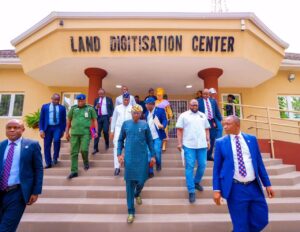
Lagos State Governor, Babajide Sanwo-Olu, has launched an electronic Geographic Information System (e-GIS) which provides digitised access to all data on the state land before a purchase is facilitated.
The e-GIS portal – a one-stop digital platform that sanitises and revolutionises the process of acquiring, documenting, and verifying land in Lagos – was launched by Sanwo-Olu in Lagos on Friday, January 26, 2024.
Sanwo-Olu said the portal had transformed land allocation in the state while bringing precision to the economic value of land.
The governor described land in Lagos as “golden egg”, noting that the new technology-driven administration system had sanitised and enhanced transparent governance in land transactions in Lagos State.

He said: “Before now, Lagosians used to experience a nightmare in getting their land titles and search data on land they wanted to purchase.
READ ALSO: Lagos govt mulls investment in airline operations
The e-GIS platform will give our customers delightful experience in services and turnaround time. This innovative and automated process has transited land transactions in the metropolis from manual paper form into a digital format, interpreting them into our land registry’s workflow.”
Governor Sanwo-Olu said he was pleased that the innovation would reduce transaction turnaround time on land acquisition and resources committed to search for data.
The new platform, Sanwo-Olu said, would foster collaboration among the government’s agencies in the land administration ecosystem, facilitating data integration among Ministries of Physical Planning and Urban Development, Environment and Water Resources, Science and Technology, Transportation, and Works and Infrastructure.
By adopting Momentum Land Administration Solution software, Sanwo-Olu said Lagos has joined the global league of cities using technology to create sustainable solutions.
Also speaking at the event, the Special Adviser to the Governor on e-GIS and Urban Development, Dr Olajide Babatunde, said the e-GIS office was set up by Sanwo-Olu to streamline data of MDAs and create single database that would ease the troubles hitherto experienced by the public in land administration system.
For further data integration, Olajide said the governor also established 20 e-GIS units across MDAs which required automated spatial data in their daily operations.
“This system has enabled us to adopt a participatory approach to ensure that we provide, enable, adapt, and sustain not only the buildings and infrastructure built for the portal but also protect public trust,” he added.


